
A significant winter storm is forecast to impact eastern Newfoundland beginning late Tuesday and continuing through Wednesday, bringing heavy snowfall, strong winds, and hazardous travel conditions to much of the region.
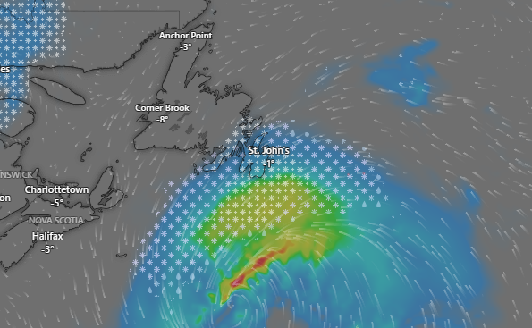
Forecasts from Environment Canada indicate snow will spread into the area Tuesday evening, intensifying overnight and persisting through much of Wednesday. Widespread snowfall totals of 15 to 25 cm are expected, with locally higher amounts possible in areas that experience heavier snow bands.
The snow is expected to be wet and heavy, which may lead to difficult driving conditions, especially during the height of the storm. Reduced visibility is likely at times, particularly in open and exposed areas.
Strong winds will accompany the system, with coastal and exposed regions seeing gusts that could approach 90 to 100 km/h, while inland areas may experience gusts in the 60 to 80 km/h range. These winds may contribute to blowing snow and drifting, further complicating travel.
Motorists are advised to plan for slow and hazardous driving conditions, particularly Tuesday night and Wednesday morning. The combination of heavy snow and strong winds may also result in localized power outages, especially in coastal communities.
Weather advisories are expected to be updated as the storm approaches, and residents are encouraged to monitor forecasts and warnings closely and adjust travel plans as needed.
Conditions are expected to gradually improve late Wednesday or Wednesday night as the storm system moves east of the province.