
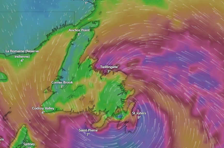
A rapidly-intensifying storm system is on course to pound Newfoundland’s east coast in the coming days, prompting warnings of dangerously high winds, possible damage, and disruption across the region.
Meteorologists say the storm bears many of the hallmarks of what’s commonly described as a “weather bomb” — technically a case of Explosive cyclogenesis, where the central pressure in a low-pressure system plunges quickly and vicious conditions result. According to the Met Office in the U.K., a “weather bomb” occurs when a cyclone’s central pressure drops about 24 millibars in 24 hours.
What’s coming
According to forecasts for the St. John’s area:
-
Tonight into early Wednesday, expect clear to partly cloudy skies that will gradually turn increasingly cloudy.
-
A Wind Warning is already in effect for the east coast of Newfoundland and the northern Avalon Peninsula. Gusts are expected to reach 80 km/h, and up to 100 km/h along portions of the coast.
-
The strongest winds are forecast to arrive Tuesday afternoon into Wednesday evening, and continue overnight into Wednesday night.
Why this storm is hitting hard
The conditions favouring this type of storm include:
-
A strong contrast between cold air and warmer maritime air, which fuels rapid intensification.
-
The “drawing in” of surrounding air as the central pressure falls rapidly, creating a steep pressure gradient and thereby very strong winds.
-
Over coastal and marine areas like Newfoundland, the combination of warm ocean waters and cold air aloft makes the region especially vulnerable to such explosive systems.
Impacts & risks
Residents should prepare for:
-
Downed trees and power lines: Gusts of 100 km/h or more can uproot trees, blow debris onto roads and damage structures.
-
Flying debris: Secure outdoor furniture, decorations, loose roofing material and anything that can be picked up by the wind.
-
Power outages: With high winds expected and the region’s exposure to storms, outages are a strong possibility.
-
Hazardous travel conditions: Gusting winds may impact driving, especially for high-profile vehicles; coastal travel and marine activities will be especially risky.
-
Rapid weather changes: Conditions may deteriorate quickly, giving less time to react.
What you should do now
-
Secure outdoor items: bring in or tie down any loose objects, siding or other materials around your home.
-
Prepare an emergency kit: include flashlights, batteries, non-perishable food, water, chargers, blankets, any needed medications.
-
Stay informed: monitor local alerts from Environment and Climate Change Canada, local news, and weather apps for updates.
-
Avoid being outside during peak wind periods if possible. If you must travel, let someone know your route and arrival time.
-
Charge your devices and keep a battery-powered radio handy in case of power interruption.
Final word
While the term “weather bomb” may sound dramatic, the phenomenon it describes is very real — and capable of serious damage, especially in vulnerable coastal and maritime regions. Residents of the Avalon Peninsula and other at-risk areas should treat the upcoming storm with caution, prepare now, and heed any instructions from local authorities.
Stay safe out there, and keep an eye on developing alerts.