
The Forecast Overview
A developing area of low pressure will pass south of Cartwright tonight, moving northeast into the Labrador Sea. This system’s departure will bring an end to snowfall for much of Newfoundland and Labrador overnight, except for a few lingering coastal flurries in Labrador and western Newfoundland. However, snowfall will ramp up in eastern parts of the province, particularly the Avalon and Bonavista Peninsulas, starting overnight and persisting through most of Thursday.
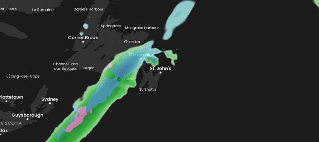
Snowfall Breakdown
Attached to this low-pressure system is a cold front carrying a narrow band of snow. Between late tonight and Thursday, this front is expected to slow down—or even stall—over the Avalon and Bonavista Peninsulas. This will result in continuous snowfall in these areas, with accumulations ranging from 5 to 15 cm. The heaviest amounts, closer to 15 cm, are anticipated between Grates Cove and Cape St. Mary’s. Areas just east and west of this corridor will see lower totals, with amounts dropping off sharply to the west—meaning minimal snowfall for the Burin Peninsula.
Because this is a small-scale weather event, forecast uncertainty remains. Even a slight shift in the snowfall band’s position could change which areas see the most accumulation. The exact placement of this band will become clearer by late tonight or early Thursday morning.
Looking Ahead
Beyond Thursday’s snowfall, conditions will stabilize across Newfoundland and Labrador on Friday and Saturday, bringing relatively calm weather. However, the next significant system is expected to arrive Sunday, delivering a mix of rain and freezing rain as a push of warmer air moves in. Temperatures are projected to rise noticeably on Monday, with highs reaching the upper single digits to low teens across much of the province.
Stay tuned for updates as this system develops!